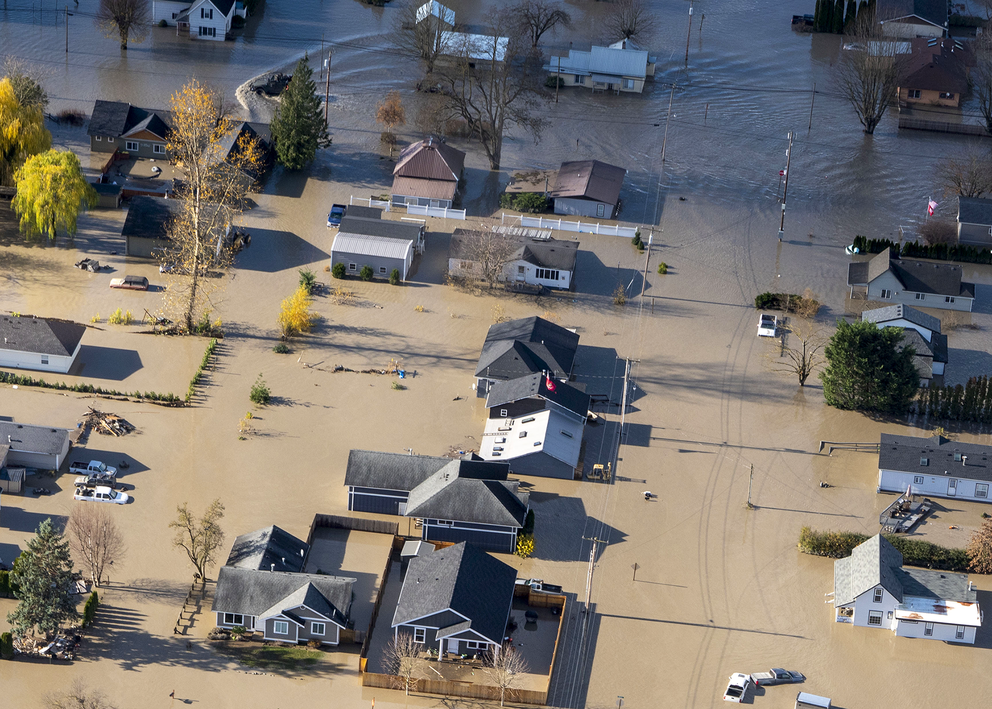
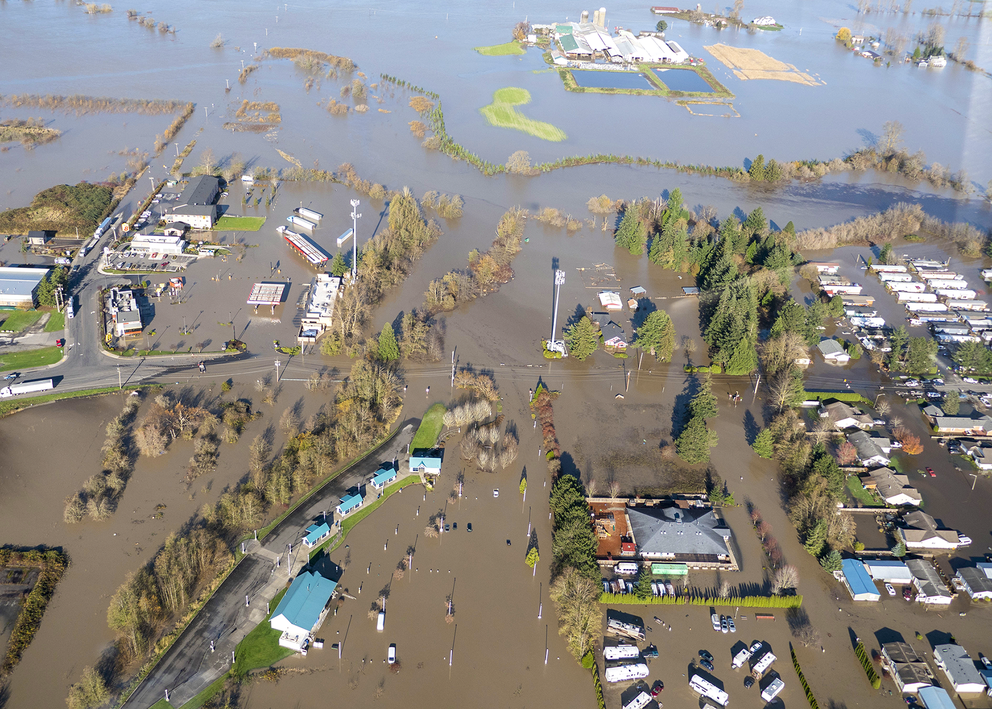
Just a few months later, in November, a powerful flood plowed through the county, drenching farmlands, isolating communities, damaging 2,000 properties and displacing hundreds of people, who even now wait in limbo for federal aid.
This story was produced as part of a collaboration with the Center for Public Integrity, Columbia Journalism Investigations and Type Investigations.
The Nooksack River, in a way, has been sounding the alarm. As global efforts to curb climate change flounder, communities like this one are forced to endure its harshest impacts. Ransacked by two disasters on the Nooksack last year, Whatcom County has found new energy and purpose in a holistic planning process to adapt to the river now — in a changing climate that brings more and more uncertainty.
This local effort, called Floodplain Integrated Planning, faces many challenges — not the least of which is maintaining trust between the various groups involved. But as climate change provides a steadily increasing stream of disasters across America, communities can take note of what’s been happening in Whatcom County.
“This past year really positioned us to be able to tackle climate change more head-on and more quickly,” said Deborah Johnson, a river and flood engineer with Whatcom County’s Public Works Department and a member of the Floodplain Integrated Planning steering committee. “People have suffered greatly as a result of the situation we’re currently in. They’re energized now, and more willing, I think, to entertain ideas about climate change that they wouldn’t have before.”
Balancing interests
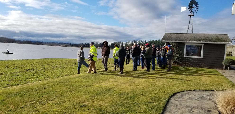
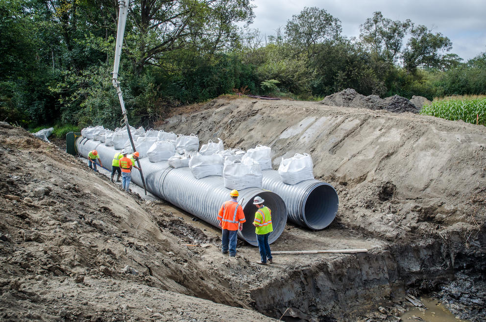
Rich Appel, a local dairy farmer in Whatcom County, knew he had to change his floodgate, an adjustable gate that can block off water flow. “The old pipes were deteriorating,” he said. But he wondered how to go about it in a way that would benefit not only his farm, but the salmon and the county too as it deals with flooding issues.
Integrating the needs of fish, farms and floods is the goal for the Floodplain Integrated Planning team. It accomplishes this through collaboration between the Nooksack Tribe and Lummi Nation, local farmers and the cities, along with support from researchers and specialists.
“From different meetings with the tribes, we learned how fish could benefit from the farmland. While we don’t have hatchery habitat — they’re not laying eggs down here in the lower valley — we do have rearing capacity. And that’s important too,” Appel said.
So, Appel opted for a fish-friendly floodgate — one that provides fish with safe passages and rearing habitat, along with protection during floods. The new floodgates also help drain floodwaters off the farmland faster.
With the new floodgate, Appel was one of the first farmers to participate in the Floodplain Integrated Planning project. Created in 2017, it is working on implementing lasting solutions throughout the floodplain that integrate the needs of salmon while reducing flood risk in the county and building climate resilience in anticipation of worsening disasters.
The Appel Farms floodgate is regarded as “a champion project,” highlighting the collaborative nature of Floodplain Integrated Planning and inspiring more farmers to get involved with the initiative. “Now, we’ve done multiple other floodgate projects like that which balance the needs of fish, farms and flood risk reduction,” Johnson said.
Ultimately, the goal of Floodplain Integrated Planning is to revamp the county’s 1999 Comprehensive Flood Hazard Management Plan, the region’s roadmap for reducing flood risk. “The 1999 plan was very siloed on flood risk reduction,” Johnson said. The updated plan will take a more holistic approach, looking at the watershed as a whole, and aiming to ensure that all the needs within the floodplain are met.
“That means for fish, we’re looking at how to restore habitat and keep salmon populations healthy. For people in the floodplain, we’re working on reducing flood risk and getting them out of harm’s way. For the farms, we’re looking at how we use the floodplain to ensure that we maintain sustainable agriculture in the community,” said Johnson.
There is no timeline to complete this updated plan — it may take at least five years or more to complete. Then it will remain a living document, evolving with new research and adapting to future climate needs.
In the meantime, the Floodplain Integrated Planning team is making headway on projects that have strong support from the tribes and other stakeholders. These smaller, ongoing projects show progress on the ground and help inform future, long-term planning goals. They are also practical.
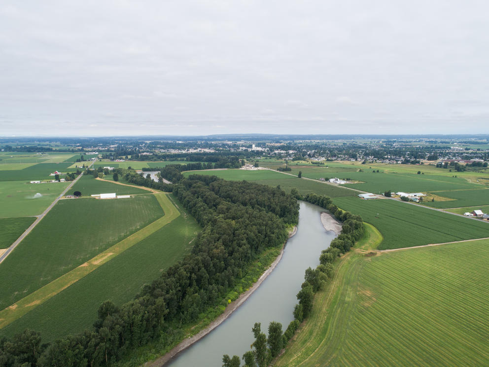
The Nooksack River and surrounding watershed is an extremely complex system, one that human activity has significantly changed over time. Levees, or earthen ridges constructed along rivers, were built alongside it. The channel was straightened, and forests were cleared. Farmlands spread across the land, and cities rose right alongside the river. Each change affected the river, how and where it floods, and its ecology.
Restoring the entire watershed right away would not be feasible. “So we do it one bite at a time, asking what can we do that would benefit this area for the next 100 years?” Appel said. “We build more trust with each project that we do, and for now, we are working our way through it, like a jigsaw puzzle, one piece at a time.”
So, throughout the floodplain, there are numerous ongoing projects that include other fish-friendly floodgates, levee repairs and property buyouts and acquisitions to remove homes placed precariously in the floodway — or the natural path of the river — and therefore at risk of serious flood damage.
Also under the umbrella of the Floodplain Integrated Planning are fish camp projects, like the one along the South Fork of the river, that integrate flood risk reduction with salmon habitat restoration. Larger projects to create set-back levees — located away from the river channel, allowing rivers to meander and have more room to flood — like the one in Lower Canyon Creek, are being discussed, but collective agreement has yet to be reached.
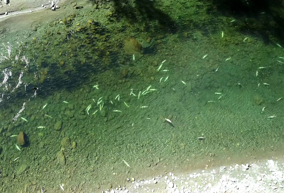
Recently completed is the Abbott Levee Habitat Improvement Project that revamped an eroding levee system and improved fish habitat by recreating logjams — natural accumulations of wood that span across a river. Logjams are essential habitat for salmon. They are a refuge for the fish to rest and create deep pools of cold water that are critical during summer, when extreme heat can be fatal, as it was in the summer of 2021.
The past five years of the Floodplain Integrated Planning process have been encouraging for the different groups involved.
For the tribes, protecting the salmon is essential. “From the tribes’ perspective, they gave up a lot,” said Ned Currence, the fisheries resource protection program manager for the Nooksack Tribe. “They gave up the lands that everybody else has profited on, and all they got were their treaty rights in exchange. But the river is degraded now.”
“So the Floodplain Integrated Planning mission is broader than just flood risk reduction. It’s an opportunity to continue exercising their treaty rights. The river provides for the lifeblood of the tribal membership,” Currence said.
Frank Lawrence III, deputy director for the Lummi Nation’s Natural Resources Department, stresses the significance of integrated solutions in the floodplain. “These projects need to happen. The salmon need to go home to where they were born. They deserve to have rest areas along the river, to feed their own spirits, to eat. We have to at least try and get things back to the way they used to be.”
As for the farmers, “the farming community recognizes that we can provide solutions, especially to salmon recovery and flooding issues,” said Fred Likkel, executive director of Whatcom Family Farmers, a farming advocacy group.
For the small cities, “the mayors are looking at ways to protect citizens when the floods come,” said Dale Buys, a civil engineer who represents the small cities for the Floodplain Integrated Planning team. “The beauty of this process is that all the different communities are represented. We openly express our priorities and then figure out how to proceed.”
Overall, there is a lot of excitement about Floodplain Integrated Planning. “We are well positioned to take on the role of being a leader in building climate resilience. People are thinking about how we’re really going to solve this problem, and it’s not going to be by building higher levees or dredging the river. We need to address how this river functions and how the floodplain changes with the climate,” Johnson said.
And they are making headway. “We have the ears of our County Council members, our state representatives and the governor,” Johnson said.
Still, despite the expressed optimism, the Floodplain Integrated Planning team faces numerous challenges.
Navigating obstacles
The Floodplain Integrated Planning team is navigating three main obstacles:
1. Time. It’s getting crunched as disasters are coming faster and faster.
2. Funding. Securing and managing funds from local, state, federal and private sources comes with its own set of problems.
3. Trust. Maintaining trust between groups involved — the Nooksack Tribe and Lummi Nation, the agricultural community, the small cities and public works officials — is crucial.
Efforts to build trust within the Floodplain Integrated Planning team have been largely successful. Still, there are roadblocks.
Most recently, an ongoing water rights adjudication process obstructed progress for the Floodplain Integrated Planning team. The premise of water law in Washington is first in time, first in right. Adjudication is a “legal process to resolve conflict and competition on a water source,” according to the Department of Ecology, and it “legally determines whether each water right on a source is legal, how much water can be used, and its priority during shortages.” In other words, those with the oldest, thus most senior use for water have priority over more junior entities in times of diminished water supply.
“Adjudication really slowed things down for a while, demotivating some people at the table to keep working collaboratively,” said Paula Harris, Whatcom County’s river and flood manager.
But maintaining trust is of utmost importance for the Floodplain Integrated Planning mission, stakeholders said. So, if there is friction between those at the table, time is taken to remedy the situation. “We sit down as people to hear each other out to get a better perspective,” Harris said. “This process is fluid. No matter what, we are adaptable and fix whatever’s broken.”
And as climate disasters increase in frequency and severity, long-term recovery efforts are put on hold to deal with immediate needs. “The November flood feels like it just happened. Staffing is a challenge, and there’s burnout. We’ve all been working on the recovery phase, but if we have another big flood, we’ll be dealing with compounding emergencies and compounding recovery,” Johnson said.
Without trust, securing funding becomes difficult. “There’s money out there, but different funding sources are more willing to work with communities when they have an agreed upon plan,” Appel said.
Floodplain Integrated Planning is primarily funded through grants from Floodplains by Design, a public-private partnership that coordinates state and local investments with locally driven floodplain restoration projects. They awarded the initiative about $15.5 million for projects to be completed between 2019 and 2023.
“Overall, it’s a small amount of money compared to the need for the large-scale flood risk reduction and climate resilience actions,” Johnson said. “We need to leverage our state representatives to unlock state and federal funding sources that will address the issues on the scale that's needed.”
Not only are the funds limited, but getting the grants can be arduous. “Everybody’s competing for the same funds, because these problems are not just in our watershed, and everybody wants the best for their community,” Lawrence said.
Funding also comes from entities like the U.S. Army Corps of Engineers for levee repairs, and the home buyouts and acquisitions are done with state funds and federal programs like FEMA, accompanied by a slew of complications, like long wait times to receive federal funds.
Add on permitting challenges, widespread communication barriers and various, intricate rules regarding floodplain restoration, and the Floodplain Integrated Planning team has its work cut out for it.
Still, Whatcom County’s team remains optimistic about the possibilities to revitalize the Nooksack River. More than anything, they are motivated by a shared vision for a climate-resilient future, and a bonding love for the Nooksack.
“The river is like spiritual healing. We have to protect it, because a new year is coming and we never know what’s going to happen,” said Lawrence.
This story was produced for InvestigateWest on August 15, 2022. InvestigateWest is an independent news nonprofit dedicated to investigative journalism in the Pacific Northwest. Visit invw.org/newsletters to sign up for weekly updates.

